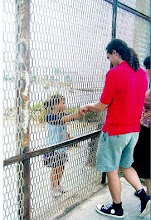
DIRECTIONS TO BEACH AT THE US/MEXICO BORDER FENCE (scroll down for exact written directions!!)
Note - These directions are to go directly to park. If you want directions on how to get to the meeting point for the Border Wall-k, email dan.watman@gmail.com for a copy of the flyer.
(scroll down for exact written directions!!)


Directions to US Side:
Take I5 to Dairy Mart Rd. Exit. Turn South/Southwest onto Dairy Mart Rd. Dairy Mart Road turns into Monument Rd. All together it's about a 3 mile drive from the I5 exit. (You will pass Smuggler's Gulch entrance just past Holister Road on your left off of Monument). If the park is closed to vehicles, it is still always open to foot, bicycle, and horses. You will come to a closed gate about 1.5 miles from the beach. There is a dirt parking lot there and you can walk/ride the rest of the way in.
Directions to Mexico Side:
If you are crossing the border, right after crossing get over to your far right lane and you will see a sign that says "Playas". Take that exit and follow the road along the border fence for about 3 miles. The road will turn South away from the fence and you'll see another sign that says "Playas" to the right. Take that exit and continue to follow the signs that say "Playas" (stay to your right). Finally, you will come to a stop light right next to a huge dirt parking lot that is for the Bull Ring "El Toreo". Turn right and go about 1/2 mile to the beach. Walk or drive north down the coastal Rd till you get to the fence. We'll be either at the park/garden at the end of that rd or down on the beach.
Note - These directions are to go directly to park. If you want directions on how to get to the meeting point for the Border Wall-k, email dan.watman@gmail.com for a copy of the flyer.
(scroll down for exact written directions!!)


Directions to US Side:
Take I5 to Dairy Mart Rd. Exit. Turn South/Southwest onto Dairy Mart Rd. Dairy Mart Road turns into Monument Rd. All together it's about a 3 mile drive from the I5 exit. (You will pass Smuggler's Gulch entrance just past Holister Road on your left off of Monument). If the park is closed to vehicles, it is still always open to foot, bicycle, and horses. You will come to a closed gate about 1.5 miles from the beach. There is a dirt parking lot there and you can walk/ride the rest of the way in.
Directions to Mexico Side:
If you are crossing the border, right after crossing get over to your far right lane and you will see a sign that says "Playas". Take that exit and follow the road along the border fence for about 3 miles. The road will turn South away from the fence and you'll see another sign that says "Playas" to the right. Take that exit and continue to follow the signs that say "Playas" (stay to your right). Finally, you will come to a stop light right next to a huge dirt parking lot that is for the Bull Ring "El Toreo". Turn right and go about 1/2 mile to the beach. Walk or drive north down the coastal Rd till you get to the fence. We'll be either at the park/garden at the end of that rd or down on the beach.


0 Comments:
Post a Comment
<< Home